Opal prospecting in NSW
Mineral exploration for opals is termed prospecting, conducted under an Opal Prospecting Licence or Mineral Claim. Opal Prospecting Licences are granted over much larger areas than those granted under mineral claims but are purely for prospecting and do not authorise mining.
NSW Resources can grant an Opal Prospecting Licence over lands defined as an 'Opal Prospecting Block' within an area designated under the Mining Act 1992 as an 'Opal Prospecting Area'. There are several Opal Prospecting Areas in the Lightning Ridge and White Cliffs Mineral Claims Districts.
You can view the Opal Prospecting Areas through MinView.
If you are interested in applying for a mineral claim, refer to the Mineral claim application and renewal process page or contact the team at Lightning Ridge on
Phone: +61 (02) 6820 5200
Fax: +61 (02) 6829 0825
Email: lightningridge.office@regional.nsw.gov.au
Postal: NSW Resources, Department of Primary Industries and Regional Development, NSW, PO Box 314 Lightning Ridge NSW 2834
Office: 41 Opal Street Lightning Ridge NSW 2834
For further information
Review of environmental factors
NSW Resources has procured a Review of Environmental Factors (REF) of Opal Prospecting Area 4 (OPA4) in the Lightning Ridge Mineral Claim District (LRMCD), which will assist in identifying environmental considerations of opal mining and potential constraints in some areas.
Specialist consultants mapped the environmental factors for OPA 4 and developed a rating of the potential impact that standard opal mining activity could have on the environment. Areas of higher environmental significance have been mapped so that they can be considered when applications for opal mining are received in these areas.
You can access the different layers of constraints mapping that shows the environmental considerations in Minview. It is important to note that although in a few areas the environmental constraints may be significant enough to limit mining, the large majority show environmental constraints that require consideration, and some areas have no environmental constraints identified. For the majority, it may mean higher levels of environmental assessment need to be undertaken by any mineral claim applicant, mitigations put in place on mineral claim conditions, higher security payable or on-ground inspection by the Resources Regulator.
You can view the REF and associated technical reports here:
Appendices
- Appendix A Biodiversity assessment (PDF, 9.55 MB)
- Appendix B Historial heritage assessment (PDF, 46.75 MB)
- Appendix C Aboriginal heritage impact assessment (PDF, 3.35 MB)
- Appendix D Contaminated land searches (PDF, 6.59 MB)
- Appendix E Visual impact statement (PDF, 25.11 MB)
- Appendix F Social assessment (PDF, 649.54 KB)
- Appendix G Example opal prospecting checklist (PDF, 3.13 MB)
Please note that the documents above are not fully accessible.
If you require assistance with the REF or viewing the maps in Minview, please contact the Small-Scale Titles project team at sstproject@regional.nsw.gov.au or by calling: 02 40636900
The department has developed a frequently asked questions document to assist you in interpreting the REF.
Temporary prohibition of new mineral claims over OPA 4 pending the independent review.
Excluding opal prospecting blocks 200 and 202, the department will not accept new mineral claims over OPA4 until the Independent Review into Small Scale Titles framework is complete.
For further details, refer to the s173A(1) Order in NSW Government Gazette 364 and NSW Government Gazette 210 of Friday 7 June 2024.
Opal prospecting methods
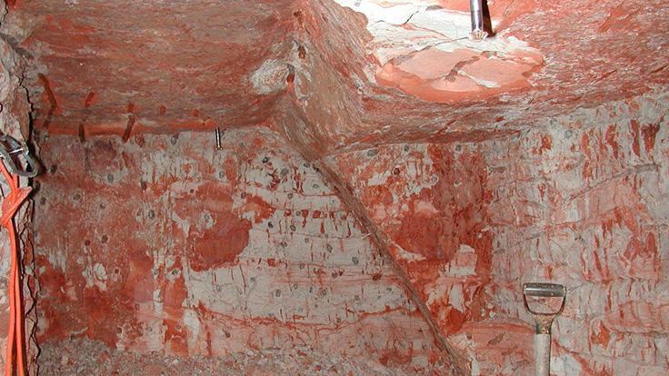
Opal is found by working underground from shafts, by auger/percussion drilling, by geophysical method, or by treating old dumps that surround shafts. Prospecting methods used are extremely variable.
Shaft sinking
Until about 1987, most of the prospecting on the opal fields was carried out by sinking a shaft to intersect the claystone, then developing drives horizontally to test the value of the opal dirt. The shafts were traditionally sunk by hand or by Caldwell drill. The process is relatively slow and costly.
Auger drilling
The end of the 1980s saw the rapid introduction of the 230 mm (9") diameter auger drill. This technology redirected the emphasis in prospecting away from shaft-sinking to gain access to the opal clays, toward testing for the existence of the necessary overlying sandstone, and looking for colour in the small sample of clays that the auger drill produced.
In most cases, the use of auger drills to assess the opal-bearing potential of an area is quicker and more cost-effective than shaft-sinking. Layers of silcrete up to a few metres thick, which are common on plateau areas, slow the rate of drilling considerably. Silcrete may occur as large slabs that are more or less continuous, or as scattered boulders through the soil profile.
In 2002, the department recorded an average of 28 holes drilled per Opal Prospecting Licence. The number of holes drilled is only restricted by the miner's budget with prospectors generally drilling between 10 and 100 holes on a given licence. Prospectors are required to backfill test holes in accordance with NSW Resources' standards.
Percussion drilling
Smaller-diameter (>120 mm) percussion drilling rigs have also been used in recent years with some success. Although they create a smaller hole, with smaller samples than auger drills, they are quicker and readily penetrate silcrete.
Prospectors are required to backfill percussion drilling holes in accordance with department's standards
SIROTEM — a geophysical method
In 1986, the Geological Survey of New South Wales trialled the geophysical method, SIROTEM, on the opal fields. This technique uses electrical current to measure the varying resistance of the underlying rocks, and in doing so, provides information that can be readily interpreted to indicate where sandstone, claystone and faults are likely to exist. The benefits of this method are that large areas of ground can be tested quickly to provide a comparative assessment of the areas before drilling.
In more recent times, ground radar has been trialled as a means of identifying areas with potential for opal-bearing clays.
These geophysical techniques remain in their infancy as far as the opal fields are concerned, but have the potential to become an important tool for the opal prospector.
Opal prospecting land access arrangements
Access Management Plans
Under the Mining Act 1992, NSW Resources can declare any land within an OPA as an Access Management Area.
Within these areas, prospecting should comply with an Access Management Plan (AMP). Where no AMP is in place, the right of way is:
- indicated by marker posts along the right of way
- outlined another manner as agreed to in writing by the landholder and the holder of the opal prospecting licence or mineral claim.
An AMP may include the following:
- the rights of access to the land, to access points, routes of access across the land, and the time periods when these rights apply
- the conditions relating to maintenance of routes of access, preserving the safety of people and stock, and avoiding interference with land management practices
- environmental protection
- dispute resolution.
The landholder and the relevant ‘miner’s representative’ prescribed in the Mining Regulation 2016 may negotiate an AMP. The ‘miner’s representative’ may commence the process by issuing the landholder a notice of intent to negotiate an AMP. The notice of intent must include a plan and description of the land over which access is sought and a description of the intended prospecting method. If the landholder and ‘miner’s representative’ reach an agreement on the terms of an AMP, the agreement must be documented in writing and lodged with NSW Resources for registration. NSW Resources is required to give public notice of the AMP and keep copies available for public inspection.
If the landholder and ‘miner’s representative’ are unable to reach an agreement on an AMP within 60 days of the notice of intent being issued, either party may apply to NSW Resources to determine an AMP. The party making the application to MEG must provide a copy of the application to the other party. Before making a determination, NSW Resources must consult with both parties and consider submissions arising from the consultation process. Once NSW Resources makes its determination it must issue copies to each party. At any time during its considerations, NSW Resources may choose not to make a determination and provide written notice to each party of that fact.
If NSW Resources declines to make a determination either party can apply to the NSW Land and Environment Court (LEC) to make a determination. The LEC’s determination is final, and copies of the determined AMP must be provided to each party.
Either party can also apply to the LEC to review a NSW Resources-made determination. The application must be lodged within 14 days of NSW Resources issuing the determination. The applicant must provide copies to both the other party and NSW Resources.
NSW Resources is not a party to any proceedings before the LEC regarding an AMP but may choose to make a submission, which the LEC must consider before making its determination. Each party is responsible for bearing its own costs for participating in any LEC proceedings.
Access to Lightning Ridge OPAs
All OPAs at Lightning Ridge are in a declared Access Management Area. The Lightning Ridge Miners Association and the Glengarry Grawin Sheepyard Miners Association have been prescribed as the ‘miner’s representative’. You can see a copy of the Access Management Plans within this area from the NSW Resources' Lightning Ridge Office.
Access to White Cliffs OPA
The OPA at White Cliffs is not within a declared Access Management Area, therefore, an AMP cannot to be implemented.
Permit to enter land
Any person can apply for a permit to:
- inspect an opal prospecting block
- mark out and inspect a mineral claim
- comply with a condition of a mineral claim or opal prospecting licence.
NSW Resources issues these permits under section 254 of the Mining Act 1992. A permit grants the holder permission to enter the land for a maximum 28 days.
A permit may not be granted over:
- land on which a house is situated that is the occupant’s principal place of residence, or land within 200 m of the dwelling-house, or
- land on which a garden is situated, or land within 50 m of the garden.
A permit may not be granted over land where ‘significant improvements’ have been made. The Act defines a ‘significant improvement’ as a work or structure that meets all of the following criteria:
- is a substantial and valuable improvement to the land
- is reasonably necessary for the operation of the landholder’s lawful business or use of the land
- is fit for its purpose (immediately or with minimal repair)
- cannot reasonably co-exist with the exercise of rights under the authorisation or the access arrangement without hindrance to the full and unencumbered operation or functionality of the work or structure
- cannot reasonably be relocated or substituted without material detriment to the landholder
- includes any work or structure prescribed by the regulations for the purposes of this definition but does not include any work or structure excluded from this definition by the Regulations.
Unless the permit specifies otherwise, a permit holder and any employee, or their agent, may only enter the land between the hours of 9am to 5pm from Monday to Friday (excluding public holidays).
The permit holder must comply with all reasonable landholder requests in relation to the manner and time of entry, provided the requests do not prevent the permit holder from carrying out the activities authorised by the permit.
In entering the land that is the subject of the permit, the permit holder must have the permit in their possession and produce it if requested to do so by the landholder.
The application form for a permit to enter land can be downloaded here (PDF, 237.33 KB).
Rights of way
An opal prospecting licence or mineral claim holder is entitled to a right of way between the OPB and a public road. Where practicable, the right of way should follow existing roads or tracks and must comply with the conditions of any registered AMP applying to the land. A right of way must be indicated by marker posts along the route, unless agreed to in writing by an alternate means between the landholder and the permit holder.
Marker posts must be installed at:
- the start and end of the route
- intervals of no more than 250 m
- each point where the route changes direction.
Each marker post must display position coordinates as well as the licence number or identification code for the licence being granted the right of way.
The licence holder must cover the cost of installation and maintenance of marker posts, and provide the relevant landholder(s) with a map showing their right of way.
Other conditions applying to a right of way include:
- It must not pass over any garden, orchard or land under cultivation, or any land on which is situated a ‘significant improvement’, unless consent is provided by the landholder
- It cannot be used by the licence holder before 7 am or after 6 pm, unless consent is provided by the landholder,
- It cannot be used during or less than 24 hours after rainfall unless consent is provided by the landholder,
- The licence holder must ensure that landholder’s gates and/or grids are in place wherever fences are intersected by the right of way. This includes ensuring that any rabbit/marsupial/dog-proof gates are placed at all intersections with existing rabbit/marsupial/dog-proof fences. A fine of up to $5,500 may apply if the licence holder fails to meet this requirement
- The licence holder must pay the costs of installing and maintaining any such gates or grids along the right of way.
If a dispute arises regarding a right of way, either the licence holder or the landholder may apply to the LEC to seek a determination of the matter.
Frequently asked questions
Can an AMP be replaced?
Subject to its provisions, an AMP can be replaced, and a new AMP remade. If an AMP was determined or reviewed by the LEC, it can only be replaced or remade by the LEC.
What is the duration of an AMP?
An AMP will terminate over the land if the existing landholder for any reason ceases to continue to be the landholder. If the land is sold and ownership transferred, the AMP must be replaced.
What are the costs associated with opal land access arrangements?
Access Management Plans
The miner’s representative and the landholder must pay their own negotiating costs regarding an AMP, including where MEG or the LEC determines the AMP.
Permit to enter land
There are no costs associated with acquiring a permit to enter land. If the permit holder causes damage while on the land, the landowner is entitled to a reasonable amount of compensation.
Rights of way
If the LEC is required to make a determination on a right of way, each party must pay their own costs for the proceedings.
Opal prospecting licences
Opal prospecting licences are granted for the purpose of exploring for opal over opal prospecting blocks (OPBs) which divide the OPAs 1 & 2 (PDF, 110.39 KB), 3 (PDF, 110.28 KB), and 4 (PDF, 128.94 KB).
Area
Applications must be in respect of designated opal prospecting blocks within an opal prospecting area. The size of blocks vary but do not exceed 500 hectares.
Duration
Opal prospecting licences are granted for a period of either 28 days or 3 months over designated opal prospecting blocks at Lightning Ridge and White Cliffs.
Conditions
There are conditions for opal prospecting licences in the individual opal prospecting areas:
- Conditions of an opal prospecting licence for Opal Prospecting Area 1 & 2 (PDF, 110.39 KB)

- Conditions of an opal prospecting licence for Opal Prospecting Area 3 (PDF, 110.28 KB)
- Conditions of an opal prospecting licence for Opal Prospecting Area 4 (PDF, 128.94 KB)
- Conditions of an opal prospecting licence for Opal Prospecting Area 4 -Barfield (PDF, 145.88 KB)
Fees
In accordance with Schedule 8 of the Mining Regulation 2016, lodgement fees are payable in addition to an administrative levy (PDF, 37.21 KB). Visit the Lightning Ridge fees and charges web page.