Finding new groundwater supplies – western NSW
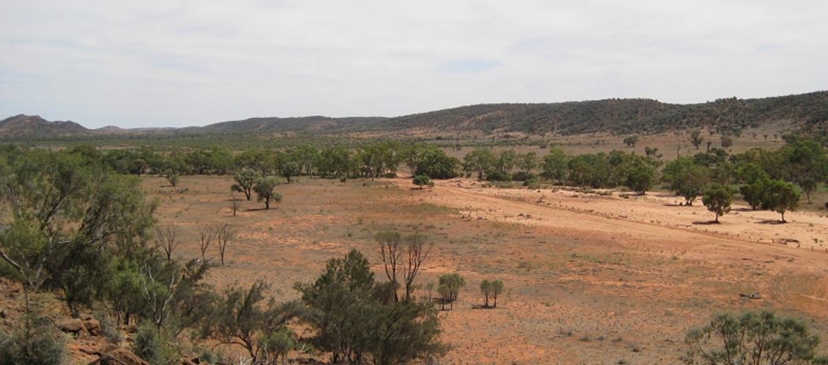
The eastern boundary of Bancannia Trough at Mutawintji National Park.
This project is part of the NSW Government’s response to drought.
The Geological Survey of NSW is investigating alternative groundwater resources to help western NSW. Such supplies could be used in times of drought, for agriculture and industry to reduce dependence on current potable water supplies. Newly discovered groundwater resources are likely to be deeper than those currently being used and may require treatment for some uses.
Two areas have been chosen to investigate new groundwater resources:
- the Yathong–Ivanhoe Trough
- the Bancannia Trough.
The Yathong–Ivanhoe Trough is south of Cobar, where the local economy is based on agriculture (mainly grazing) and mining (gold, silver, copper, lead and zinc). The domestic water supply is being upgraded, with new pump stations to be added to existing infrastructure. Water is currently piped over 125 km from Nyngan.
The Bancannia Trough is northeast of Broken Hill, which is well supplied with water using a 270 km pipeline from near Wentworth on the Murray River. The Menindee Lakes and other water infrastructure lie to the southeast of Broken Hill.
Finding additional groundwater resources in the northwest corner of the state will help to ensure consistent supply during times of drought, providing water security for isolated communities, pastoralists and businesses there. This will reduce the usage of potable water for activities that don’t require high water quality.
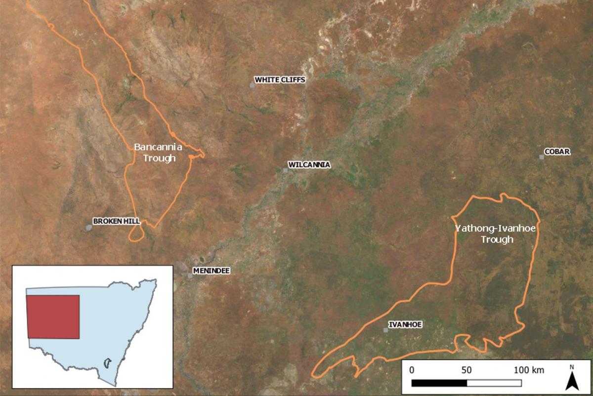
The Bancannia Trough and Yathong–Ivanhoe Trough will be explored for additional groundwater resources.
Water exploration activities
The Geological Survey of NSW is creating 3D geological models of the Yathong–Ivanhoe Trough and Bancannia Trough to help identify groundwater resources.
Field mapping
To inform the 3D models, geological field mapping is being done to improve understanding of the surface geology. This is a low impact activity, with descriptions of outcrops recorded and some hand specimens taken for microscopic examination. Much of the two targeted areas has not been mapped in detail. Various outcrops visible on satellite imagery have been chosen for investigation, provided access is granted.
Observations and measurements are available online through MinView in the 'Geological field observations' layer. Once surface mapping is completed, a summary report will be added to DIGS, a publicly available and searchable library of geological information about NSW.
Seismic surveys
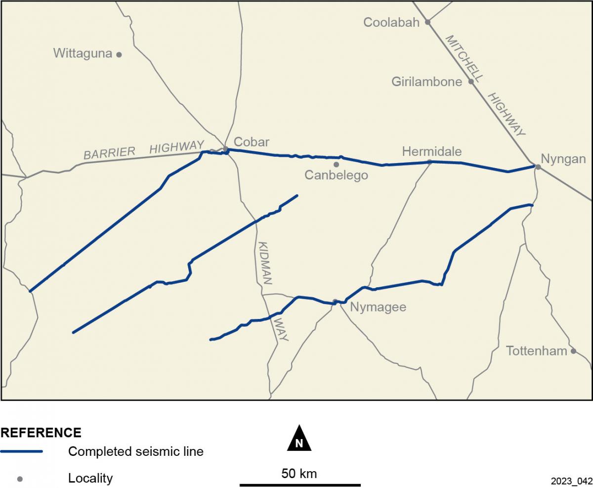
A seismic survey was conducted in 2023 to further understand the Yathong–Ivanhoe Trough. This was a low impact, ground-based geophysical survey. Seismic surveys help to build an image of the geology under the ground. Vehicles move along a route and generate energy vibrations that penetrate the ground and bounce off buried rocks. The reflected energy is recorded by a series of sensors.
Following roads, fire trails and existing farm tracks, no clearing was necessary for the survey. Disturbance to traffic, residents, livestock and wildlife was minimal. Two trucks transferred sound energy to the ground and were supported by vehicles for equipment, communication and personnel. When the survey was complete, all equipment was removed from the site.
Three lines were completed for the northern part of the Yathong–Ivanhoe Trough and eastwards to the Cobar Basin, finishing near Nyngan. Data over the Cobar Basin will be used for mineral mapping as part of another project.
Completed seismic survey
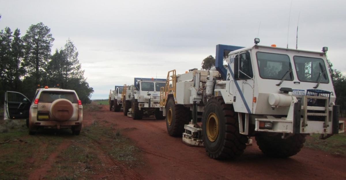
Vibroseis trucks generate energy in the ground by lowering a plate and vibrating, while the vehicle is stationary. A support vehicle and back-up vibroseis truck are also shown.
Drilling for groundwater
The NSW Government is carrying out drilling in the Bancannia Trough, around 100 km northwest of Broken Hill, to look for deep groundwater resources.
The program will commence in May 2024 when up to 5 drillholes will be drilled to depths of 200 – 400 metres, taking approximately 2-3 months to complete, weather permitting.
This drilling is in support of the NSW Government’s response to drought, focused on identifying emergency groundwater to support agriculture, towns and industry.
Results will be used to determine if the water can be used and for what purposes.
The results will be used by government and farmers, to expand their knowledge of the geology and groundwater resources.
For more information on the Bancannia drilling or other drilling programs contact: geo.projects@regional.nsw.gov.au
Airborne surveys
Two airborne surveys have been completed in collaboration with Geoscience Australia for the Yathong area: an airborne electromagnetic survey (AEM) and an airborne magnetic and radiometric survey (AMR). The AEM survey was completed in May 2023 and the AMR survey was completed in September 2023.
Map of airborne survey areas:
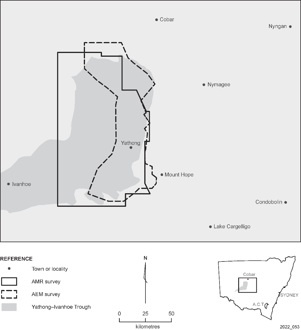
An interactive map of the AMR survey areas and weekly updates on process are available on MinView.
A comprehensive community engagement plan informed the community and stakeholders about the surveys.
The AMR and AEM data will be made publicly available after processing late in 2023. If you wish to receive the data, please contact geophysics.products@regional.nsw.gov.au
Yathong airborne electromagnetic survey
The AEM survey is complete. It measured the natural electrical properties of rocks and soil up to 400 m deep. These properties vary depending on the type of rocks and soil, and the water content, and salinity. The data collected will help us to understand the geology and groundwater resources of the area, assisting the government and farmers to make informed decisions.
A specialist and experienced contractor undertook the survey. A helicopter flew at a height of 70 m, with a sensor suspended 35 m below, along east-west lines, up to 2.5 km apart. It flew higher over towns and buildings and avoided groups of stock. The aircraft deviated from east-west lines to provide data over waterbores and drillholes to help geoscientists interpret the data.
For more information on AEM surveys, see our fact sheet and videos.
Yathong airborne magnetic and radiometric (AMR) survey
An AMR survey measures small variations in Earth's magnetic field caused by different rock types and the naturally occurring radiation coming from the ground. AMR surveys use passive sensors, are non-invasive and do not disturb the ground. For more information on AMR surveys, see our fact sheet.
This survey will increase the resolution of our existing AMR coverage, and will improve our knowledge of the rocks, faults, soils and groundwater of the area.
A specialised and experienced contractor undertook the survey from May to September 2023. A plane flew 80 m above the ground along east‒west-oriented lines 60 to 90 km long and 200 m apart. Some lines were flown north-south to 'tie' the data together. The plane flew higher over towns and buildings and avoided groups of stock.