GIS web services
GIS web services provide direct access to data, eliminating the need to download a dataset and import it into your desktop application. Instead they use a simple HTTP interface (URL) to access the data. The New South Wales Geological Survey (GSNSW) uses a variety of services including Web Map Services (WMS), Web Map Tile Services (WMTS) and Web Feature Services (WFS) provided by the Open Geospatial Consortium (OGC).
Datasets available as web services include NSW Seamless Geology, drillholes and mineral occurrences.
How to use GIS web services
The URLs below for WMS, WMTS and WFS services are the service endpoint URLs. They will not resolve in a simple web browser (like Internet Explorer, Chrome, or Firefox). The service endpoint URLs can be used in desktop mapping applications (e.g. QGIS, ArcGIS, MapInfo) and specialised web portals like the Geoscience Portal.
For more information on how to use GIS web services in QGIS, ArcGIS and MapInfo mapping applications please read the GIS Web Services User Guide (PDF, 1.46 MB).
Interoperability
Like other Australian and New Zealand geoscience agencies, New South Wales aims to deliver WFS data as OGC-compliant interoperable services using the international standards GeoSciML and EarthResourceML for boreholes, mines and mineral resources.
OGC Services
| Service Type | URL |
|---|---|
| WMS | https://gs.geoscience.nsw.gov.au/geoserver/ows?service=wms&version=1.3.0&request=GetCapabilities |
| WMTS | https://gs.geoscience.nsw.gov.au/geoserver/gwc/service/wmts?REQUEST=GetCapabilities |
| WFS | https://gs.geoscience.nsw.gov.au/geoserver/ows?service=wfs&version=1.1.0&request=GetCapabilities |
NSW Seamless Geology
| Service Type | URL |
|---|---|
| WMS | https://gs-seamless.geoscience.nsw.gov.au/geoserver/ows?service=WMS&version=1.3.0&request=GetCapabilities |
| WFS | https://gs-seamless.geoscience.nsw.gov.au/geoserver/ows?service=WFS&acceptversions=2.0.0&request=GetCapabilities |
GIS web services catalogue
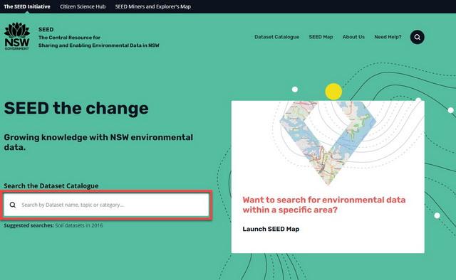
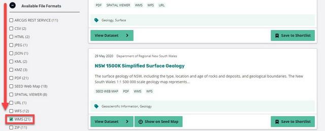
GIS web services for environmental datasets published by NSW Government can also be found through the SEED Portal. Follow the steps below to find data available as a WMS.

Go to https://www.seed.nsw.gov.au/
-
Enter you search term and select WMS as the format

-
Select View Data for the dataset you are interested in

-
The WMS (URL) is listed under Dataset web services, which is a subheading below the dataset name.
